Current:
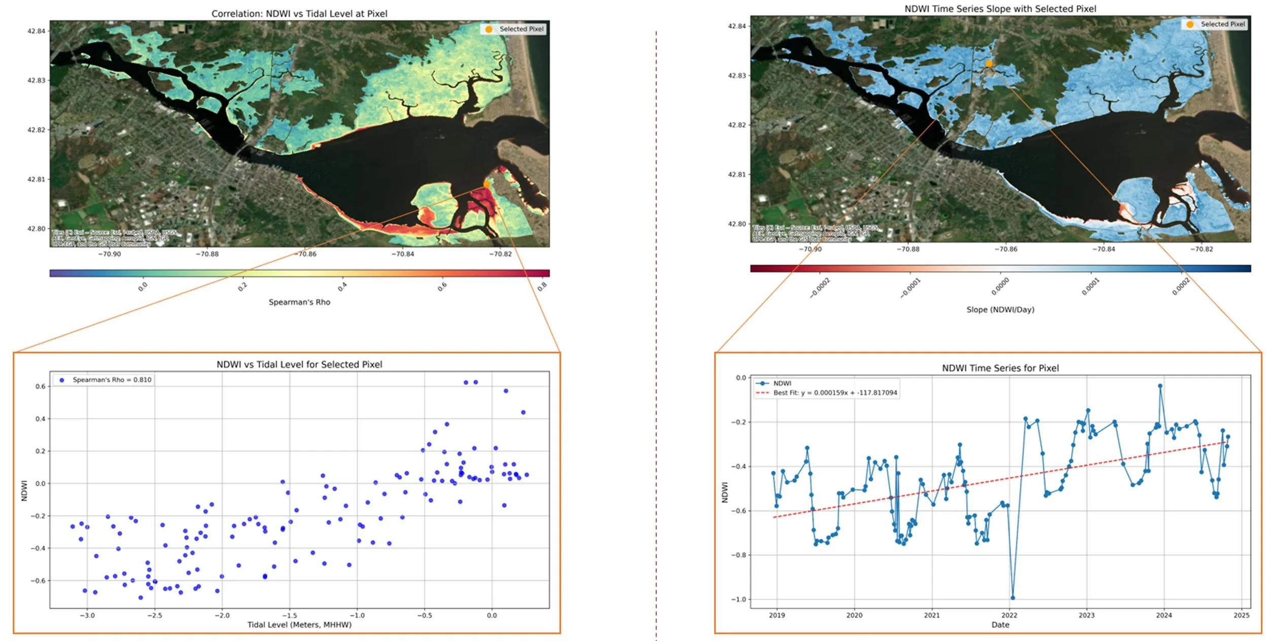
Salt
Marshes
As a Postdoctoral Research Associate at University of Massachusetts, I am working with a team of UMass scientists, MassDEP, and collaborators statewide to monitor the health (hydrology | ecology | geomorphology) of the state’s salt marshes and restoration project efficacy.
I use satellite remote sensing paired with environmental monitoring and field data to identify physical trends, change points, and tipping points.
In Progress:
Wave
Turbidity
In the absence of freshwater, waves control nearshore turbidity. By eroding and transporting sediments from beach berms and seabeds (think rip currents), these turbid processes are essential to nearshore morphologic balances and also effectively become tracers of the cross-shore mixing they induce. While this process has been studied in sandy environments with a focus on recreational safety, wave mixing in rocky coasts has been severely under-studied and no published remote sensing studies exist in any environment.
In this work, we use high resolution satellite imagery, corrected with deep learning image postprocessing to resolve nearshore heterogeneity (tidally appearing boulders and extremely reflective and spatiotemporally inconsistent foam) to study wave driven nearshore turbidity in rocky and sandy environments, finding distinct differences in supply and transport mechanisms


Past work:
Speiser, William H., and John L. Largier. "Long-term observations of the turbid outflow plume from the Russian River, California." Estuarine, Coastal and Shelf Science 309 (2024): 108942.
Speiser, William H., and John L. Largier. "High-Resolution Nearshore Sea Surface Temperature from Calibrated Landsat Brightness Data." Remote Sensing 16.23 (2024): 4477.

